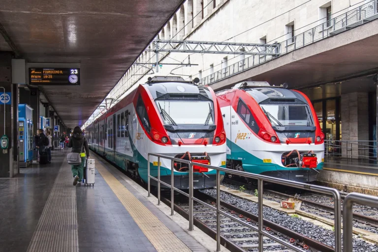
In the center of Rome, you can use the metro (Metropolitana di Roma) to travel affordably and quickly over long distances. Unlike the metro systems in cities like London or Paris, the metro network in Rome is quite small, consisting of only three different metro lines. The metro lines in Rome have a total length of 47 kilometers and encompass 71 stations spread throughout the center of Rome and some suburbs.
Many of Rome’s attractions are easily accessible via metro lines A and B. The metro in Rome is one of the fastest ways to travel from one side of the city to the other. Especially during the colder winter months or in bad weather, the metro is the ideal way to cover large parts of Rome.
Metro stops in Rome are clearly marked by red square signs with a white M in the center. Metro stations often have multiple entrances on both sides of the street or intersection, so you don’t have to cross the street to access the metro.
Metro lines in Rome
In Rome, there are three different metro lines: line A (red/orange), line B (blue), and line C (green). Metro line A runs from the northwest to the southeast of the city, while metro line B runs from the northeast to the southwest of Rome. These two lines intersect at only one metro stop, the Roma Termini Station. At this point, you can transfer from one line to another, but it is also possible to transfer to a bus or train. The newest metro line in Rome, line C, crosses the red line at the San Giovanni station and the blue line. Once the entire line C is completed, it will also intersect the blue line at the Colosseo station and the red line at the Ottaviano station.
In Rome, the metro runs mostly underground, with the exception of a section between the Lepanto and Flaminio metro stops, where the metro travels above ground to cross the Tiber River. Many stations are deeply hidden underground, requiring multiple escalators to descend, but there are also some stations located just below the surface, requiring only a short escalator ride down.
As a tourist in Rome, you will primarily use line A during your visit. Along the red metro line A are most of Rome’s attractions, such as St. Peter’s Basilica, the Vatican Museums, Cinecittà, the Spanish Steps, and the Basilica of St. John Lateran.
The blue metro line B will mainly be used by tourists to travel to the Colosseum or Circus Maximus. The blue line also stops near the Basilica of St. Paul Outside the Walls and the Pyramid of Cestius.
The metro map below provides a complete overview of all metro lines and metro stops in Rome. Click on the image to enlarge the metro map..

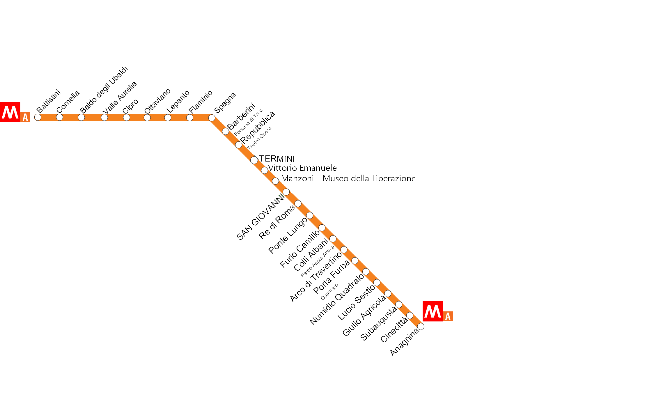
Red Line – Line A (Linea A)
The red metro line A, also known as Linea A by the Romans, is a total of 19 km long and has 27 different stations. The metro line starts at Anagnina and runs to Battistini. The red/orange line has the following stations:
Anagnina
Cinecittà
Subaugusta
Giulio Agricola
Lucio Sestio
Numidio Quadrato
Porta Furba-Quadraro
Arco di Travertino
Colli Albani
Furio Camillo
Tuscolana
Ponte Lungo
Re di Roma
San Giovanni
Manzoni
Vittorio Emanuele
Termini (Central station – bus and train)
Repubblica
Barberini (stop for the Trevi Fountain)
Spagna (stop for the Spanish Steps)
Flaminio (stop for Piazza del Popolo)
Lepanto (stop for Castel Sant’Angelo)
Ottaviano – San Pietro (stop for St. Peter’s Square)
Cipro (Musei Vaticani) (stop for the Vatican Museums)
Valle Aurelia
Baldo degli Ubaldi
Aurelia-Cornelia
Battistini
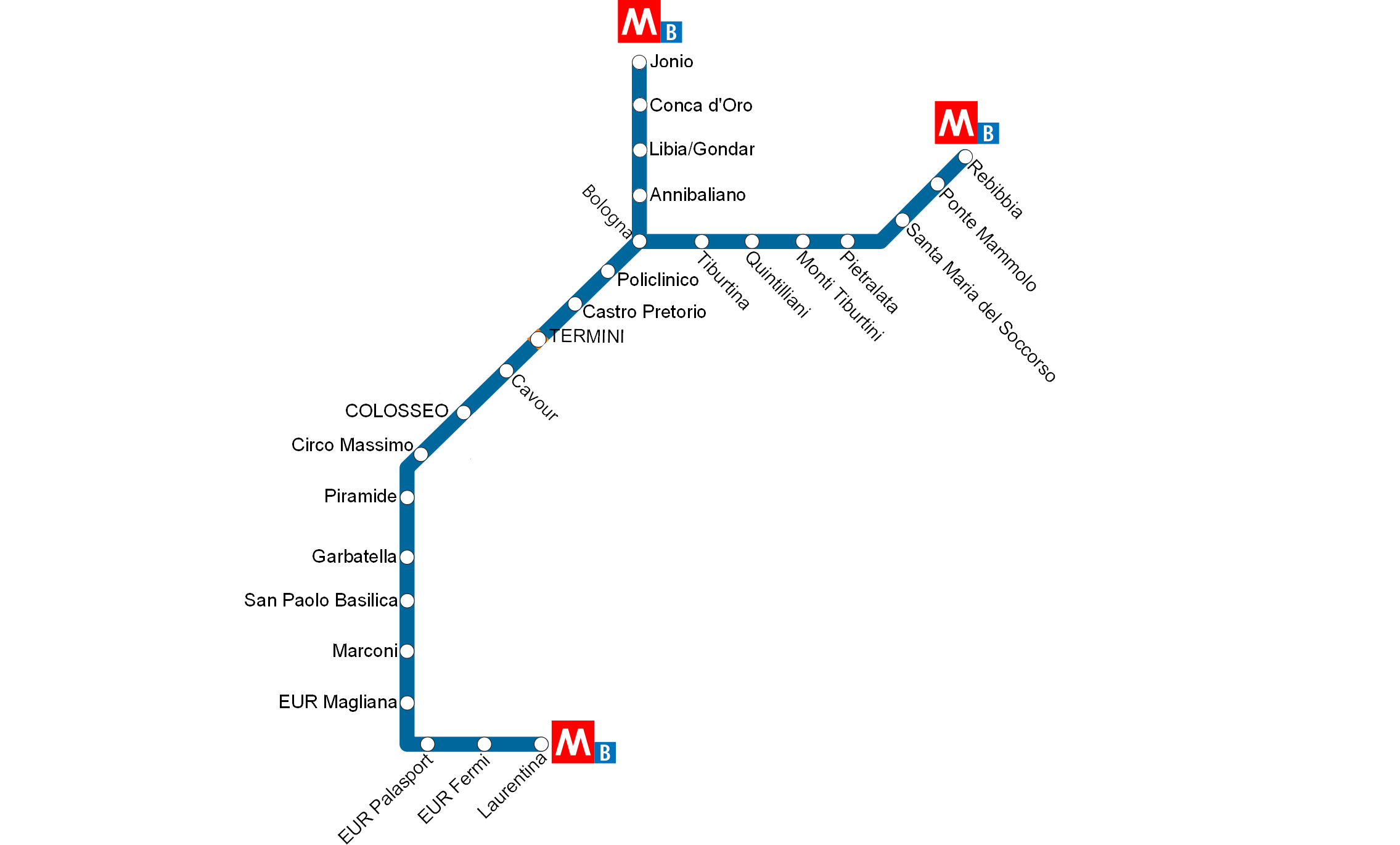
Blue Line – Line B (Linea B)
The blue metro line B, also known as Linea B by the Romans, is like the red metro line, a total of 19 km long and has 22 stations. The blue metro line starts at Laurentina and runs to Rebibbia, with a branch (B1) that veers off to Conca d’Oro. Metro line B has the following stations:
Laurentina
EUR Fermi
EUR Palasport
EUR Magliana
Marconi
Basilica San Paolo
Garbatella
Piramide
Circo Massimo (stop for Circus Maximus)
Colosseo (stop for the Colosseum)
Cavour
Termini (Central station – bus and train)
Castro Pretorio
Policlinico
Bologna
Tiburtina
Quintiliani
Monti Tiburtini
Pietralata
Santa Maria del Soccorso
Ponte Mammolo
Rebibbia
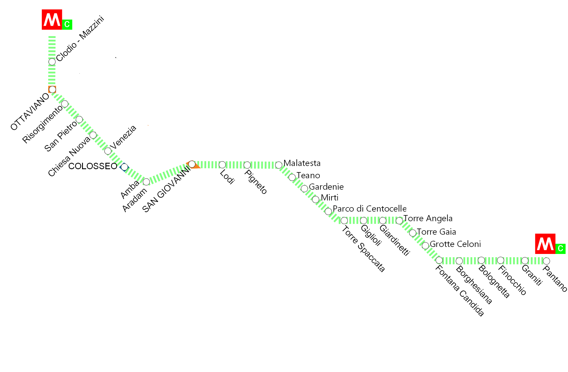
Green Line – Line C (Linea C)
The green Line C is the newest metro line in Rome and is a total of 19 kilometers long. This metro line is still partially under construction, and due to archaeological discoveries made during construction, this line has experienced several years of delay. The first section of the new Line C was opened in 2014, and since May 2018, the green Line C runs from Monte Compatri-Pantano station to San Giovanni station. When the construction of the line is completed, expected around 2022, the line will extend to Fori Imperiali-Colosseo station where you can transfer to the blue metro line.
Once Line C is complete, it will have a total of 30 stations. Since May 2018, 22 of the 20 planned stations are in operation. Line C has the following stations:
San Giovanni
Lodi
Pigneto
Malatesta
Teano
Gardenie
Mirti
Parco di Centocelle
Alessandrino
Torre Spaccata
Torre Maura
Giardinetti
Torrenova
Torre Angela
Torre Gaia
Grotte Celoni
Due Leoni-Fontana Candida
Borghesiana
Bolognetta
Finocchio
Graniti
Monte Compatri-Pantano
More information about the metro in Rome
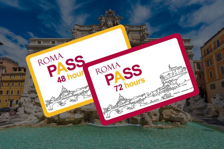
Do you want to have unlimited access to public transportation during your city trip in Rome? Then you can opt for the Roma Pass, which allows you to enjoy free public transportation in the city for 48 or 72 hours. Additionally, with this discount card, you also get free access to one or two museums in Rome, including the Colosseum.
You can easily purchase the special Roma Pass online through the Tiqets website. More information about the Roma Pass can be found on our “Roma Pass page”.